With the development
of commercial air services (and radio) in the 1930s came the need for a supporting
ground organisation. This need was reinforced by the tragic losses of the first
ANA's Avro X Southern Cloud in 1931, Airlines of Australia's Stinson VH-UHH
in 1937 and the second ANA's DC3 Kyeema in 1938.
At first marine radio stations were used for communication with aircraft, but soon a dedicated air traffic services organisation was established, one that continues to play a vital role in safe air transport today. A network of radio navigation beacons was also established, the beginning of the Department's involvement in the development and provision of a range of aids to navigation.
A list of Unit and equipment acronyms used on
this site
Read
about Coastal Radio Stations in the
Early Days of Communications With Aircraft
NOTAM 6/1940 giving callsigns for Aeradio Stations
Read
about the HF Communication
Stations of Sydney
Inside
Sydney's Llandilo HF
transmitter station
Read about the HF Communication Stations of Melbourne
Photos of HF field strength measuring using a DCA DC-3 - c.1962
The AWA Air Mite lightweight VHF radio - 1948
The Phonetic Alphabet - Old & New
Read about the 'Q' code
Download a Movie Clip: A Position Report, 1950s-style
Photo of the interior of a Douglas DC-4 c.1950 showing the size of aircraft radio equipment
DCA's first computerised message switching system - 1973
Photos of and information about a Linesman at work splicing a cable - 2007
Andrews Spiracone HF antennas at Broken Hill - 2009
Read about Radio Navigation
Aids
Direction
Finding (DF)
- Photos and history of the Bellini-Tosi MF DF system - 1930s-1950s
- Photos of the High Frequency Cathode Ray Direction Finding (H/F C/R D/F) equipment - 1940
Aural Radio Range
Information about Australia's first pilot-interpreted radio navaid - the Aural Radio Range
33 Mc 'Lorenz' Radio Range
- Read the story of The 33 Mc 'Lorenz' Radio Range System
- Read the letter from C.S.Wiggins to E.C.Johnston describing the the germ of an idea to adapt the German Lorenz 'blind' landing aid for use as Australia's first standard radio navigation beacon
- See a photo of the Essendon Lorenz beacon - c.1938
- Photos of the aircraft installation of the receiver for the 33 Mc 'Lorenz' Radio Range, c.1938
- ANA advertisement 'Flying the Beam' c.1939
- Photos of the Seymour 'Lorenz' 33Mc Radio Range beacon
Homer/Non Directional Beacon (NDB)
- General Electric BC-191 transmitters used as NDBs
- A photo of the Wonthaggi Non-Directional Beacon, c.1960s, and some history about NDBs
- Photos of the Ballarat Non-Directional Beacon, 2005
Distance Measuring Equipment (DME)
- The story of The Australian DME system
- Views of a typical installation:
- DME antenna development
- Operational Notes on Distance Measuring Equipment
- An early analogue DME(A) cockpit indicator for AWA VAN 3 equipment
- 1953 ad & 1967 brochure for AWA DME equipment
Visual Aural Range (VAR)
- Operational Notes on the Visual-Aural Range (VAR) & Marker Beacons
- Photos of the prototype VAR installation at Melbourne/Essendon - 1947
- Photos of standard VAR installations at Hobart and Mangalore
- VAR Field Strength Monitoring - c.1949
- Chart showing the VAR instrument approach procedure for Melbourne/Essendon - 1960
- The spectacular and unique Cowes VAR - 1960s
- Mangalore VAR Instrument Approach Chart - 1967
- Chart depiction of VAR beacons - 1979
Multiple Track Radar Range (MTRR)
- The story of this revolutionary and pioneering Australian navaid of the 1940s - MTRR
Instrument Landing System (ILS)
- Chart showing the Runway 26 ILS Approach procedure for Melbourne/Essendon - 1968
VHF Omni-directional Range (VOR)
- Photos of AME T52 VOR beacons - c.1970s, and some history of the VOR in Australia
- Read about 'Betsy the mobile VOR', used for site testing in the 1970s
- Photo of the Melbourne T73A Doppler VOR (DVOR) - 2007
- Photos of Hobart and Launceston T73A DVORs - 2011
Microwave Landing System (MLS)
- Read a technical article about the INTERSCAN MLS
- Read a history of the development of the INTERSCAN MLS
- Photos of the experimental MLS installation at Melbourne/Tullamarine in 1977 & 2007
Download a history of airport lighting Lights
in the Night
Read a description of the lighting at Forrest in 1928 - Australia's first airway equipped for reguar night flying
Precision Visual Glidepath
- Read about the Precision Visual Glidepath landing system
- Read the Pilots Notes for the Precision Visual Glidepath
T-VASIS
- Read about the history of The T-VASIS Landing System
- Photo of the first production T-VASIS installation, Hobart - 1965
- Photo of typical T-VASIS lightboxes
- Aerial photo of a typical T-VASIS installation
- Read the Pilots' Notes on the "T"-Visual Approach Slope Indicator System
Precision Approach Path Indicator (PAPI)
Photo of a typical Rotating Aerodrome Beacon
Read about the Calvert Cross Bar Approach Lighting System
See a photo of typical approach lighting systems for a precision approach (ILS) runway.
Photos of the experimental Light Weight Air Warning radar at Essendon
- 1940s
Photos of the Type 276 experimental Aerodrome Control Radar at Essendon - early 1950s
Photo
of the Sydney CSF Route Surveillance
Radar - c. early 1960s
Photos of the Melbourne CSF Route Surveillance Radar:
Examine a chart showing the extent of radar coverage - 1967
Early satellite ranging experiments - c.1970
Read a Departmental 'Information Paper' on The Use of Radar in Air Traffic Control - c.1980s
Read an essay on Air Traffic Control surveillance systems, including the difference between Primary and Secondary radar
Early
days - Airways Survey in the DC-3 and F.27 era
Modernising - F28 and Optical Tracker
Today - Super King Air and Laser Tracker
The
Phonetic Alphabet - Old & New
Australian Company Radio Callsigns
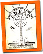
Read about the DCA publication Airway Navigational Facilities - ANFAC
Airport power supplies & downloadable A Brief History of Power Supply Systems for Civil Aviation Facilities in Australia1928-2018
Photo inside the DCA Radio Workshops at Rosehill, NSW - c.1950s
Chart showing the VAR instrument approach procedure for Melbourne/Essendon - 1960
Aktiv-Fischer ST4 Snow Trac used to service remote airways equipment - 1980s
Photo of an Isuzu 500 light truck with portable generating equipment at Essendon Tower - 2007
Download the CAHS Technical Library Catalogue (updated 6/2015 - requires Adobe Acrobat Reader)
Download a partial catalogue of the CAHS collection of Aeronautical Charts (requires Acrobat reader)
Back to the main History Menu
If this page appears without menu bars at top and left, click here