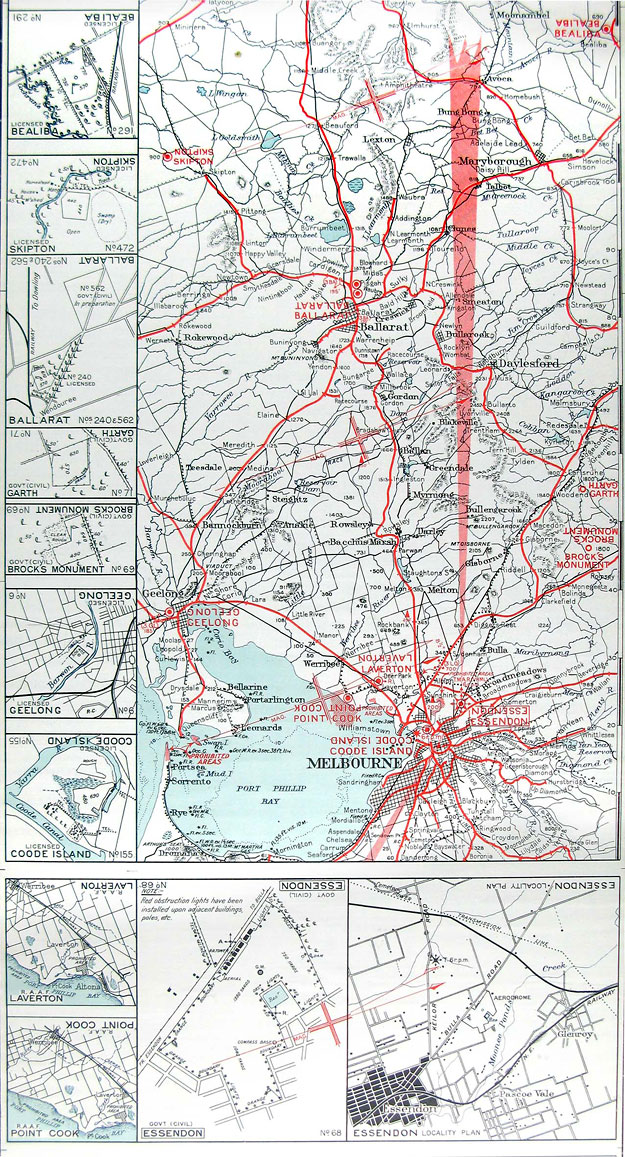
This section
of strip map for the Melbourne-Adelaide air route was issued in July 1939.
It was compiled by the Property and Survey Branch of the Department of
the Interior for DCA. It was number 5
in a series of strip maps covering the main air routes and was drawn to
a scale of 1:633,600 (10 miles to the inch).The map was printed on linen
for durability and had tabs at each end to enable it to be wound on to
a roller-board to ease cockpit use.
As navigation was still primarily by pilotage, the map shows the major terrain features in addition to roads and railways. The map also shows the course of the then new 33 Mc 'Lorenz' Radio Range. The margin of the map contained layout drawings of the aerodromes along the route. Note that they are all-over fields - runways had yet to make an appearance in most places. Notable on the section shown are the aerodromes at Coode Island and Geelong's Belmont Common, both of which were quite active at the time but no longer exist.
(CAHS collection
- original 2000 x 232 mm)
Back to the main Flying Operations index
Back to
the main Airports
& Aerodromes index
If this page appears without a menu bar at top and left, click here