The
Early Days of Civil Aerodromes
By
Roger Meyer, Dr K.N.E. Bradfield and the late Mr Jack Davis
Soon after
the Air Navigation Act was passed in 1920, the Civil Aviation Branch of the Department
of Defence (CAB) was created to regulate civil aviation in Australia. One of its
functions was to subsidise a number of air services, and to provide aerodromes
and landing grounds along these air routes. The CAB initially took over nine aerodromes
and five emergency landing grounds that were already owned by the Commonwealth.
Most of these had been prepared for the 1919
air race from England to Australia.
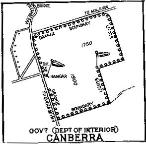
(Left: Canberra Aerodrome 1935)
The Superintendent of Aerodromes was Captain Edgar Johnston, DFC, a qualified surveyor whose task it was to select the sites for aerodromes and landing grounds, and then have the sites developed to the required standards. His first Assistant Inspector was Rupert Hoddinott, whose first job was to decide what should constitute an aerodrome. It was a new branch of engineering for which there were no textbooks. Hoddinott, in his unpublished autobiography, explained how they established the minimum ‘run’ for aircraft landing or taking off into the wind:
"First we had to decide what should constitute an aerodrome. All aircraft should be able to land or take off directly into the wind, and so an area was essential which would give the minimum run in any direction. To decide the minimum run, I produced an old photograph of an aerodrome I had used in France [in World War I] which was satisfactory for De Havilland DH9s with full war load (2 men, 224 lbs. of bombs, 2 Lewis guns, one Vickers [gun], 2,000 rounds of .303 ammunition, and various oddments). This, when measured with a scale computed from the size of a DH9 shown in the photograph, showed a minimum of 280 yards. As a factor of safety, and as we knew from survey experience that a common measurement of a paddock was 20 chains or 440 yards, we adopted that as a minimum run. As the aircraft then operating were all wartime ones, it was satisfactory."
"As the gliding angle of these aircraft was about 1 in 8 we required the approaches to be clear to 1 in 10. Surfaces were required to be reasonably smooth. Unofficially we tested them by driving a T model Ford over them at 20 miles per hour. If one could sit comfortably on the seat they were satisfactory". Click here to see a photo of early aerodrome site selection.
Hodinott continues: "Air routes had also to be designed. As engines at that time were not extremely reliable, provision had to be made for the safety of personnel in the case of engine failure on the route. Provided that an aircraft was flying at a height of 10,000 feet, it was estimated that it could be landed at some spot in a circle of 10 miles radius from a centre below the plane. Thus it was necessary to provide an emergency landing ground every 20 miles, if the country was so rough that a landing could not reasonably be made on the natural surface without preparation. The grounds were to be such that a pilot could land without injury to his passengers, and with his plane intact. They were to be as good as it was reasonably possible to make them. Ground marks to indicate the grounds were:—
(a) A white circle 20 feet in diameter and 3 feet wide marked an emergency ground.
(b) A bar across the circle indicated petrol available.
(c) A cross within the circle indicated petrol and accommodation available."
"Wind socks were provided at all grounds. Notices to Airmen (NOTAMS) were to be in the form of a proposal I had submitted with my first application. It was based on Notices to Mariners. Radio was not used and the only communication from ground to air was by pre-arranged signal, usually white sheets or fires. Air to ground was usually by message bag with streamers or Very (signalling) lights."
Aerodrome Licence No 1 was issued to Shaw-Ross Engineering and Aviation Company at Fisherman’s Bend, Melbourne, on 1 June 1921. Other early aerodromes were along the Geraldton to Derby air route - the first subsidised air service in Australia. One of the earliest areas of land officially "approved for use by aircraft" was at Cootamundra, NSW, which was on the proposed Sydney to Adelaide air route. Charleville, Tambo, Blackall, Longreach, Winton, McKinlay and Cloncurry, all in Queensland, were ahead of Essendon (Melbourne) and Mascot (Sydney), which appeared later in 1921.
Aerodrome development was a relatively simple business. Design, such as it was, was more concerned with the right type of grass mixture than the materials for pavements, and maintenance involved the cutting of grass, the burning of spinifex, or the knocking over and levelling of anthills. At some sites, local farmers had contracts to graze their horses overnight, while at more remote and infrequently used aerodromes, intended aircraft arrivals had to be notified 24 hours in advance so that cattle could be removed.
By the early 1930s attention was turning from grassed strips to simple unsealed gravel strips. The first runway strips were laid at Longreach, QLD, in the mid-1920s. However, aerodrome development was slow at this time, due partly to the popularity of Flying Boats. The Qantas DH86 aircraft which operated to Singapore on the route to the United Kingdom could use grassed fields satisfactorily. When they were replaced by flying boats in 1938 for the entire trip to England, flying boat bases were developed at Sydney (Rose Bay), Brisbane, Townsville, Karumba, Groote Eylandt and Darwin.
The outbreak of war in 1939 prompted all-out development of aerodromes throughout Australia. It was soon agreed that the Department of Civil Aviation (DCA) would look after projects at aerodromes which were expected to be of value later for civil aviation, while the RAAF would look after the rest. DCA Airport Engineers were also involved in projects in New Caledonia, Timor and Papua-New Guinea. There was little development of capital city aerodromes during the war because of large military aerodromes nearby - Amberley near Brisbane, Richmond near Sydney, Point Cook and Laverton near Melbourne.
After the war, civil aviation activity increased rapidly. Commercial aircraft sizes, speeds and reliability improved, and by the early 1950s Convairs and DC6s were being flown on the main trunk air routes. The effort in this period was directed to the capital city airports which were unsuitable for the anticipated rapid expansion in aviation. Melbourne Airport (Essendon) was a grassed all-over field until 1946 when the bitumen surfaced east-west runway was constructed, followed by the concrete north-south runway in 1947.
At Sydney, the first gravel runway (450 metres long) was constructed in 1932, and two further runways were completed in 1938. All were by now of inadequate length, width and strength for the aircraft being produced. Major redevelopment of the airport commenced in 1947 and included the diversion of Cook’s River and various roads and services, and the provision of two new runways. These works were completed in 1954 at a cost of 7.5 million Pounds ($270 million today). Click here to see a photo.
There used to be a serious seagull problem at Sydney airport, particularly along the flight paths. The basic problem was a garbage tip west of the airport which was a food source for them, and also low lying swampy areas near the airport which were their favourite habitat. While Head Office took the legal steps to have the tip closed, the swampy area between the International Terminal Building and the river had to be filled. Airports Engineer Jack Davis made a deal with the Bunnerong Power Station under which they dumped their unwanted residual fly ash in the swamp, at no cost to the Commonwealth. This area is now the international terminal car park.
Back
to the main Airports and Aerodromes
index
If
this page appears without a menu bar at top and left, click
here