The base for the Flying Doctor service in South Australia during the 1950s
was at Ceduna, at the eastern end of the Great Australian Bight. From
this base, a large part of southern South Australia was provided with
aerial medical services, including air ambulance services and regular
clinic runs to outlying settlements. There was a Bush Hospital in Ceduna
and another at Tarcoola, about 90 NM (170 km) to the north on the trans-continental
railway.
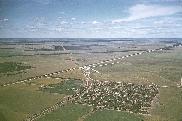
The aerial photo above shows the Flying Medical Service's base at Ceduna c.1955, looking east across the vast plain of the Australian interior.
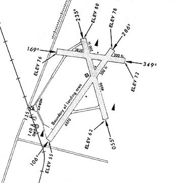
The runways are all grass and the strip of concrete 'tarmac' in front of the hangars stands out. Compare the photo with a detail (left) from the Landing Chart for 15 Jan 1968.
The aerodrome layout is much the same today, except that the runway running from bottom right to top left is abandoned, and the crosssing runway (11/29) is now a sealed all-weather strip.
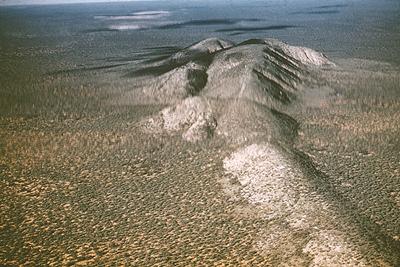
The only prominent terrain feature for many miles around was Mt Finke, see here looking east. Mt Finke was located amid a sea of mallee scrub and ti-tree some 75 NM (140 km) north of Ceduna and 32 NM (60 km) south west of Tarcoola.
Since the Flying Doctor aircraft operated, until the arrival of Lockheed 12A VH-BHH in 1957, without any form of radio navigation aid, terrain features such as Mt Finke were vital for navigation.
(Photos:
Macarthur Job collection)
Click here to see the next
in this series of Flying Doctor photos
Back to the main Items of General Interest index
If this page appears without menu bars at top and left, click
here